Europe looks like a continent on the map, but it is really the western end of Asia, and where it stops has always been a matter of choice. Its name was a puzzle even to Herodotus, the first Greek historian, around 430 BC. This chapter sets the stage for the whole story: what Europe is, where its name comes from, how its seas, mountains, plains and rivers shaped the people who lived there, and who those people were around 500 BC, when the Greek city-states, Carthage, the Etruscans and a small town called Rome shared the coasts of the Mediterranean, Celts, Thracians and Scythians lived further north, and the Persian Empire had just crossed into Europe.
A continent without a clear edge
Most continents are easy to draw. Africa, Australia and the Americas are surrounded by sea, apart from narrow necks of land. Europe is different. In the north, west and south it has coasts: the Arctic Ocean, the Atlantic and the Mediterranean. In the east there is no sea at all, only land that runs on without a break into Asia. Europe and Asia sit on one great land mass, Eurasia, and in a purely geographical sense Europe is one of Asia’s peninsulas, like India or Arabia. A school history of 1917 already put it this way: the line between the two is “more or less arbitrary”.1Webster, Early European History (1917), §20H. Webster, a school history of 1917. Its geography still holds; its views on peoples and “races” are outdatedRead on Project Gutenberg ↗
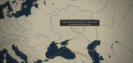
Today about 745 million people live in Europe, roughly one person in eleven on Earth, in some 44 to 50 countries; the number depends on whether Russia, Turkey, Kazakhstan, Cyprus and the states of the Caucasus are counted.2United Nations, World Population Prospects 2024Modern estimate of the population of Europe (UN region, including all of Russia)Read at the UN ↗ The usual modern line between Europe and Asia follows the Ural Mountains and the Ural River down to the Caspian Sea, then the Caucasus mountains, the Black Sea, and the two narrow straits at Istanbul and Gallipoli, the Bosporus and the Dardanelles, which lead from the Black Sea to the Aegean. Even this line is argued about in the Caucasus, where some geographers prefer the watershed of the mountains and others a lowland further north.
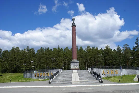
The line has moved. The earliest Greek map makers in the 6th century BC divided the world into Europe and Asia, and later Libya (Africa) as a third part. Herodotus knew of two eastern boundaries: the river Phasis, the Rioni in today’s Georgia, flowing into the eastern end of the Black Sea, and, as “some say”, the river Tanais, today’s Don, which flows into the Sea of Azov north of the Black Sea.3Herodotus, Histories 4.45.2Written c. 430–425 BC, from what Herodotus saw and was told. Translation by A. D. Godley (1920)Read on Perseus ↗ The Don line won. Later Greek and Roman geographers, such as Strabo around the time of Christ and Ptolemy in the 2nd century AD, used it, and so did most map makers for the next 1,500 years.
Only in the 18th century did the boundary move east. Russia was growing into a great power that reached from the Baltic to the Pacific, and its geographers wanted a line that made sense on the ground. In the 1720s the Swedish officer Philip Johan von Strahlenberg, a prisoner of war in Siberia, proposed the Ural Mountains, and the Russian geographer Vasily Tatishchev said he had suggested the same. Their line spread through atlases in the following century. The Urals are a low range, worn down over hundreds of millions of years, and people on either side are not very different. A continent, in the end, is a name people agree to use.
Where the name comes from
The Greeks gave the continent its name, but they did not know what the name meant. Herodotus, writing around 430 BC, was frank about it. “As for Europe”, he wrote, no one knows “whether it is bounded by seas or not, or where it got its name, nor is it clear who gave the name”.4Herodotus, Histories 4.45.4Written c. 430–425 BC, from what Herodotus saw and was told. Translation by A. D. Godley (1920)Read on Perseus ↗ The obvious answer was the myth of Europa, but Herodotus saw the problem with it: Europa “was of Asiatic birth, and never came to this land which the Greeks now call Europe, but only from Phoenicia to Crete and from Crete to Lycia”, in what is now south-western Turkey.5Herodotus, Histories 4.45.5Written c. 430–425 BC, from what Herodotus saw and was told. Translation by A. D. Godley (1920)Read on Perseus ↗ He decided not to worry about it and to “use the names established by custom”.
In the myth, Europa was a princess of Phoenicia, the coast of today’s Lebanon. Zeus, king of the gods, saw her by the sea, took the form of a beautiful white bull and carried her on his back across the water to Crete, where she became the mother of Minos, the legendary king of Crete. The story is old: a temple at Selinous in Sicily shows Europa on the bull in a stone relief of around 550 BC. Herodotus knew a more down-to-earth version, which he says the Persians told: some Greeks “landed at Tyre in Phoenicia and carried off the king’s daughter Europa”; he guessed they were Cretans.6Herodotus, Histories 1.2.1Written c. 430–425 BC, from what Herodotus saw and was told. Translation by A. D. Godley (1920)Read on Perseus ↗ Either way, the woman who gave Europe its name came from Asia.
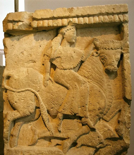
Whatever its origin, the name tells us something important. “Europe” was at first a Greek idea, and it described a direction from Greece rather than a people. Nobody in 500 BC called themselves a European. A Celt in the Alps, a Scythian on the steppe and an Athenian had nothing in common except that Greek geographers put them on the same side of a line. That idea, Europe on one side of the Aegean and Asia on the other, would become very powerful after the Persian Wars, when Greek writers began to describe the war as a struggle between the two.
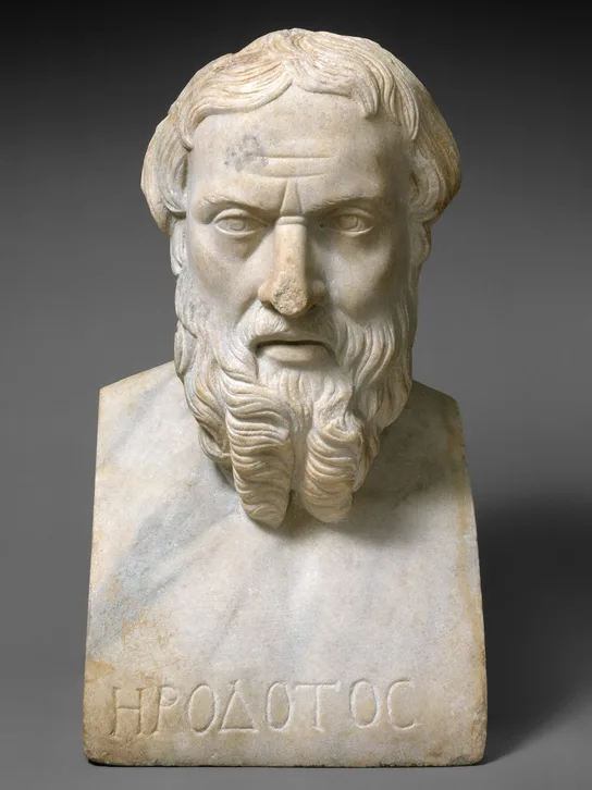
Three parts of the world
The Greeks of the 6th century BC were the first people we know of to draw maps of the whole world. Anaximander and Hecataeus, both from Miletus on the coast of today’s Turkey, drew the earth as a round disc, ringed by the river Ocean, with the Mediterranean in the middle. Herodotus thought these maps were nonsense. “I laugh”, he wrote, “to see how many have before now drawn maps of the world, not one of them reasonably”, drawing the world “as round as if fashioned by compasses”, with Asia and Europe the same size.8Herodotus, Histories 4.36.2Written c. 430–425 BC, from what Herodotus saw and was told. Translation by A. D. Godley (1920)Read on Perseus ↗ To him Europe was much bigger: it “stretches along both the others together”, along the whole length of Asia and Libya.9Herodotus, Histories 4.42.1Written c. 430–425 BC, from what Herodotus saw and was told. Translation by A. D. Godley (1920)Read on Perseus ↗
Herodotus was honest about what he did not know. Of the far west and north he wrote that he could “not speak with assurance”: he did not believe in a river Eridanus where amber came from, nor did he know where the “Tin Islands” lay. “All we know is that our tin and amber come from the most distant parts.”11Herodotus, Histories 3.115.2Written c. 430–425 BC, from what Herodotus saw and was told. Translation by A. D. Godley (1920)Read on Perseus ↗ That sentence is a good summary of what Greeks knew of most of Europe around 500 BC. Tin from Cornwall and Brittany and amber from the Baltic coast passed from hand to hand across the continent and reached the Mediterranean, but the people who dug the tin and collected the amber were almost unknown to the writers who used it.
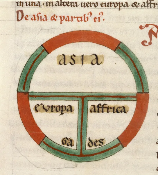
The sea in the middle
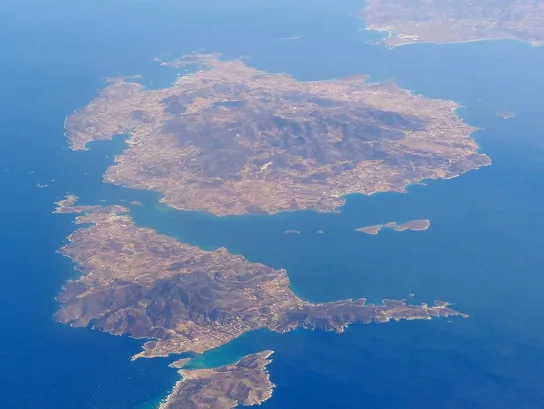
Europe’s shape has shaped its history. Its coastline is extraordinarily long for its size: seas reach deep into the land, and there are bays, gulfs and islands everywhere. In the south lies the Mediterranean, a great inland sea almost closed at the Strait of Gibraltar, which the Greeks called the Pillars of Heracles. Three peninsulas reach down into it: Iberia (Spain and Portugal), Italy, and the Balkans, with Greece at their southern tip. East of Greece the Aegean Sea is so full of islands that a sailor is rarely out of sight of land.
That mattered because, for most of history, moving goods by sea was far cheaper and faster than moving them by land. A ship could carry the load of hundreds of pack animals. Before the age of steam, a cargo of grain could cross the Mediterranean for less than it cost to cart it a hundred kilometres inland. So the coasts of the Mediterranean were connected to each other more closely than to their own interiors. Ideas, gods, alphabets, coins and armies travelled along the sea routes, and the first cities, writing and states in Europe appeared around its shores, not in the centre of the continent.
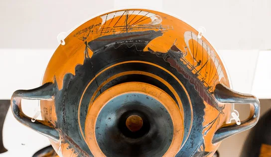
The sea also had limits. Ancient ships sailed mainly between spring and autumn; winter storms closed the sea for months. And it was not peaceful. Greeks, Phoenicians and Etruscans competed for the best harbours and trade routes, and piracy was common. Herodotus’ Phocaeans, Greeks from the coast of Asia Minor, “were the earliest of the Greeks to make long sea-voyages”, reaching the Adriatic, Etruria and Spain, and they did it “not sailing in round freightships but in fifty-oared vessels”, fast ships that could fight.12Herodotus, Histories 1.163.1Written c. 430–425 BC, from what Herodotus saw and was told. Translation by A. D. Godley (1920)Read on Perseus ↗ The line between trader and raider was thin.
Mountains, plains and rivers
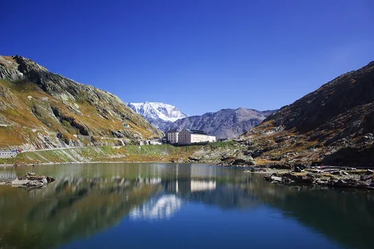
North of the Mediterranean stands a chain of mountains: the Pyrenees between Spain and France, the Alps, the Carpathians in a great curve around the plain of today’s Hungary, and the Balkan range in Bulgaria. They separate the sunny south from the rest of the continent. But Europe’s mountains are not a closed wall like the Himalayas. They have passes, and people crossed them from the Stone Age onwards: traders carrying Mediterranean wine and bronze vessels north, and, later, armies such as Hannibal’s elephants in 218 BC. The 1917 school history noted that they are “provided with easy passes”; easy is too strong for the Alps in winter, but they slowed travellers down rather than stopping them.13Webster, Early European History (1917), §20H. Webster, a school history of 1917. Its geography still holds; its views on peoples and “races” are outdatedRead on Project Gutenberg ↗
Beyond the mountains lies the North European Plain, a broad lowland that runs from western France through the Low Countries, northern Germany and Poland into Russia, getting wider as it goes east. In 500 BC much of it was covered with forest and marsh. In the south-east, north of the Black Sea and the Caspian, the forest gives way to the steppe, an open sea of grass that stretches, with few breaks, all the way to Mongolia. On the steppe there are almost no natural barriers, and it was perfect country for people who lived from herds and rode horses. Again and again in European history, horsemen came west along it: the Scythians in the 7th century BC, later the Huns in the 4th century AD, the Magyars in the 9th and the Mongols in the 13th.

Then there are the rivers. The Rhine flows north to the North Sea; the Danube rises in the Black Forest and flows east across the continent to the Black Sea; further east the Dnieper, the Don and the Volga run south across the plain, the Volga to the Caspian. Rivers carried trade far inland, long before roads did. Herodotus, who had sailed the Black Sea, called the Danube, the Ister in Greek, “the greatest of all rivers which we know”.14Herodotus, Histories 4.48.1Written c. 430–425 BC, from what Herodotus saw and was told. Translation by A. D. Godley (1920)Read on Perseus ↗ He believed it rose “among the Celts, who are the most westerly dwellers in Europe”, and at a city called Pyrene, a name that sounds like the Pyrenees.15Herodotus, Histories 4.49.3Written c. 430–425 BC, from what Herodotus saw and was told. Translation by A. D. Godley (1920)Read on Perseus ↗ His geography of the far west was confused, but he knew that one river linked the lands of the Celts with the Black Sea. Five centuries later, the Rhine and the Danube became the northern frontier of the Roman Empire.

Olives in the south, snow in the east
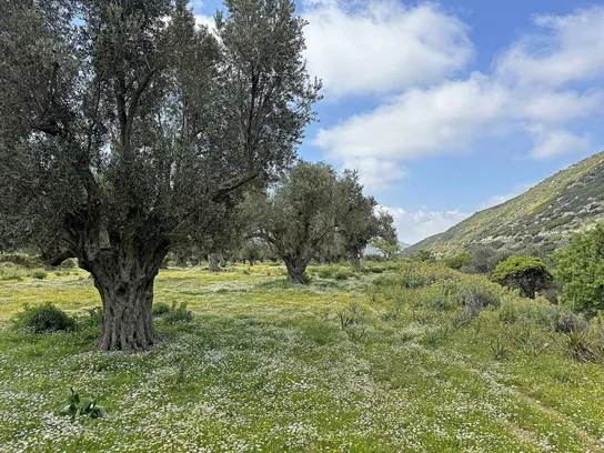
Europe’s climate changes from west to east and from south to north. Along the Atlantic coast, winds from the ocean, warmed by the Gulf Stream, bring mild winters, cool summers and rain all year. Around the Mediterranean, summers are hot and dry and winters mild and wet. This is the climate of the olive and the vine, which need warm summers and cannot stand hard frost. In the east, far from the ocean, the climate is continental: hot summers and long, bitter winters.
Climate decided how people lived. In the Mediterranean, the triad of wheat, olive oil and wine was the basis of the diet, and cities could grow up on small plains between the mountains and the sea. Further north, people grew barley, millet, rye and later oats, and kept more cattle, pigs and sheep. On the steppe, where rain was scarce, many people lived as herders on the move. The Greeks noticed these differences and often explained the character of other peoples by the climate they lived in, an idea that lasted far into modern times.
Farmers and letters from the east
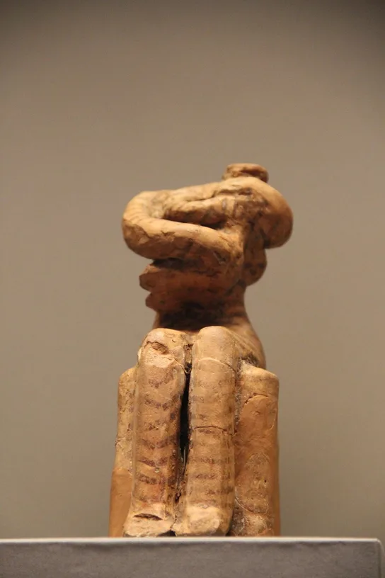
Many of the things that made Europe’s later history possible came from Asia. The most important was farming. Wheat, barley, sheep and goats were first domesticated in the Fertile Crescent, the arc of land from Israel and Syria to Iraq, and from there farming spread across the Mediterranean and into northern Europe.16OpenStax, World History vol. 1 (2022), 2.3Modern textbook by A. Kordas, R. J. Lynch, B. Nelson and J. Tatlock (CC BY-NC-SA 4.0)Read on OpenStax ↗ The first farming villages in Europe appeared in Greece more than eight thousand years ago, around 6500 BC; from there farming spread up the Balkans, along the Danube and around the coasts of the Mediterranean, reaching Britain and Scandinavia around 4000 BC.
Modern research has changed one old idea about this. Historians used to argue whether the idea of farming spread from people to people, or whether farmers themselves moved. Studies of ancient DNA since the 2010s have given a clear answer for most of Europe: the first farmers were newcomers, descended from farming families of the Aegean and north-western Anatolia, today’s Turkey, who moved into Europe and mixed only gradually with the hunter-gatherers already living there.17Z. Hofmanová et al., “Early farmers from across Europe directly descended from Neolithic Aegeans”, PNAS 113 (2016), pp. 6886–6891Modern ancient-DNA study: the first farmers of Europe descended from farmers of the Aegean and north-western AnatoliaRead on PNAS ↗ The people of Europe around 500 BC descended from three main groups: those early hunters, the farmers from Anatolia, and herders who came from the steppe around 3000 BC.
Much later came writing. The Phoenicians, traders from the coast of Lebanon, used an alphabet of about twenty-two letters for consonants. The Greeks took it over, probably in the 9th or 8th century BC, and added letters for vowels. Herodotus knew where it came from: the Phoenicians “brought with them to Hellas, among many other kinds of learning, the alphabet”, and so the Greeks called the letters “Phoenician”.18Herodotus, Histories 5.58.1Written c. 430–425 BC, from what Herodotus saw and was told. Translation by A. D. Godley (1920)Read on Perseus ↗ The Etruscans in Italy borrowed the Greek letters, and the Romans borrowed them from the Etruscans; that is the alphabet you are reading now.19OpenStax, World History vol. 1 (2022), 6.1Modern textbook by A. Kordas, R. J. Lynch, B. Nelson and J. Tatlock (CC BY-NC-SA 4.0)Read on OpenStax ↗

Europe around 500 BC
Around 500 BC is where our story of Europe begins, and the date is chosen for a reason. This is the moment when written history reaches the continent. Before it, almost everything we know about Europe comes from archaeology. From the 5th century BC onwards, Greek writers, above all Herodotus, describe events, peoples and places, and give dates we can trust. Their view is a Greek one, and they knew the Mediterranean far better than the north. But for the first time, the peoples of Europe have names.
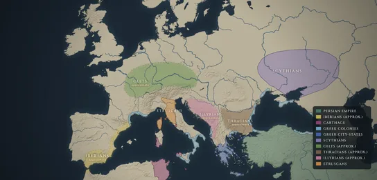
The sections that follow go around the map: first the Greeks, then their rivals at sea, the Phoenicians of Carthage and the Etruscans, with the young city of Rome; then the peoples of the north and east, the Celts, Iberians, Illyrians, Thracians and Scythians; and finally the empire that had just reached Europe from Asia, Persia.
The Greeks and their colonies
Around 500 BC the Greeks did not live in one country. They lived in hundreds of independent city-states, each with its own laws, army, coins and gods. Athens and Sparta were the most powerful; most others were small towns with a few thousand citizens and the farmland around them. They often fought each other. What made them Greeks was a shared language, the same gods and festivals such as the Olympic Games, and the poems of Homer.
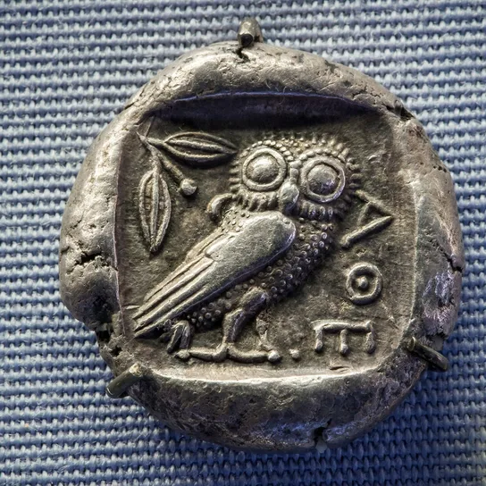
Greece itself is mountainous, with little good farmland, and from the 8th century BC onwards Greek cities sent out groups of settlers to found new cities overseas. These colonies were independent cities too, though they kept ties with their mother city. Greeks settled in such numbers in southern Italy and eastern Sicily that the Romans later called the region Magna Graecia, “Great Greece”. Phocaeans founded Massalia, today’s Marseille, around 600 BC; Thucydides says that while “founding Marseilles” they “defeated the Carthaginians in a sea-fight”.21Thucydides, History of the Peloponnesian War 1.13Written c. 400 BC; these passages look back on earlier centuries. Translation by R. CrawleyRead on Project Gutenberg ↗ Greek cities also lined the coasts of the Black Sea, from Byzantium, the later Constantinople and Istanbul, to Olbia near the mouth of the Dnieper and Panticapaeum in the Crimea. From there grain, fish, timber and slaves were shipped south to the cities of Greece.

Through the colonies the Greeks met the peoples of the rest of Europe. Greek merchants traded with everyone from the Celts in the west to the Scythians in the east. Wine, oil, painted pottery and bronze went inland; metals, grain, furs and slaves came back. Around 500 BC Athens was just starting an experiment of its own. In 508/507 BC the reforms of Cleisthenes gave power to the assembly of citizens, the beginning of Athenian democracy, the subject of the next chapter.
Phoenicians and Carthage
The Greeks were not the first to sail the western Mediterranean. Phoenician traders from Tyre and Sidon had gone before them, looking for silver, tin and other metals, and set up trading posts as far as Spain.22OpenStax, World History vol. 1 (2022), 6.1Modern textbook by A. Kordas, R. J. Lynch, B. Nelson and J. Tatlock (CC BY-NC-SA 4.0)Read on OpenStax ↗ Gadir, today’s Cádiz, beyond the Strait of Gibraltar, was founded by Tyre. The greatest Phoenician city in the west was Carthage, near today’s Tunis. Its traditional founding date is 814 BC; archaeology points to the late 9th or early 8th century BC. By 500 BC Carthage was the leader of the Phoenicians in the west, with a strong fleet.
Carthage and the Greeks competed for the same islands. In Sicily, Thucydides explains, when the Greeks arrived in large numbers the Phoenicians “took up their abode in Motye, Soloeis, and Panormus”, in the west of the island, the nearest point to Carthage.23Thucydides, History of the Peloponnesian War 6.2Written c. 400 BC; these passages look back on earlier centuries. Translation by R. CrawleyRead on Project Gutenberg ↗ Around 540–535 BC, off Corsica, the Phocaean settlers of Alalia fought a fleet of Carthaginians and Etruscans; Herodotus says the Etruscans and Carthaginians “made common cause against them” with sixty ships each. The Greeks won, but lost most of their ships and abandoned Corsica.
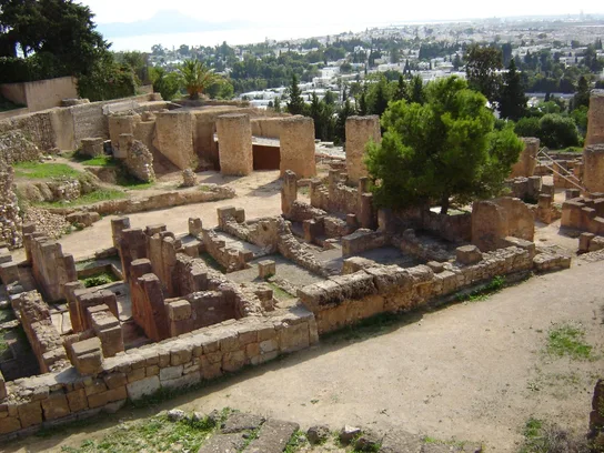
We know the extent of Carthage’s power from an unusual document. The Greek historian Polybius, around 150 BC, copied the first treaty between Rome and Carthage, made, he says, by “the first Consuls appointed after the expulsion of the kings”, around 509 BC.24Polybius, Histories 3.22Written c. 150 BC from the treaty texts kept in Rome. Translation by E. S. Shuckburgh (1889)Read on Project Gutenberg ↗ In it Romans could trade in Carthage, Sardinia and “the Carthaginian province in Sicily”, but not sail beyond a certain cape in Africa. Polybius concluded that “the Carthaginians speak of Sardinia and Libya as belonging to them entirely” but claimed only part of Sicily.25Polybius, Histories 3.23Written c. 150 BC from the treaty texts kept in Rome. Translation by E. S. Shuckburgh (1889)Read on Project Gutenberg ↗ Modern historians mostly accept the early date, though some put the treaty later. Carthaginian rule over a large part of Spain belongs to a much later age, after 237 BC; around 500 BC it was a matter of ports and trade.
The Etruscans and early Rome
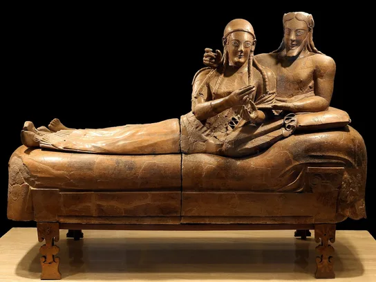
North of the river Tiber, in today’s Tuscany, lived the Etruscans. They were the richest and most advanced people of Italy, organised, like the Greeks, in independent city-states such as Veii, Caere, Tarquinia and Vulci.26OpenStax, World History vol. 1 (2022), 6.1Modern textbook by A. Kordas, R. J. Lynch, B. Nelson and J. Tatlock (CC BY-NC-SA 4.0)Read on OpenStax ↗ They mined iron and copper, traded with Greeks and Carthaginians, and imported so much Greek pottery that many of the finest Athenian vases in museums today were found in Etruscan tombs. Their language was not related to Greek, Latin or any other Indo-European language. Written in an alphabet borrowed from the Greeks, it can be read aloud, but it is only partly understood.
Where did the Etruscans come from? Herodotus told a story he had heard from the Lydians of Asia Minor: in a time of famine, half of the Lydians sailed away under the king’s son Tyrrhenus and, after long wanderings, “came to the Ombrici, where they founded cities and have lived ever since”.27Herodotus, Histories 1.94.6Written c. 430–425 BC, from what Herodotus saw and was told. Translation by A. D. Godley (1920)Read on Perseus ↗ For centuries scholars argued about it. Modern research has settled the question against Herodotus. Archaeology shows Etruscan culture growing out of the earlier Villanovan culture of the same region, and a large study of ancient DNA in 2021 found no sign of a migration from Anatolia: the Etruscans were genetically much like their Latin neighbours around Rome.28C. Posth et al., “The origin and legacy of the Etruscans through a 2000-year archeogenomic time transect”, Science Advances 7 (2021), eabi7673Modern ancient-DNA study of 82 people from Etruria and southern Italy, 800 BC – AD 1000: no sign of a migration from AnatoliaRead on Science Advances ↗
On the southern bank of the Tiber, at a ford where the trade route along the coast crossed the river, stood Rome. Around 500 BC it was a town of the Latins, one of many in central Italy, though a large one. According to Roman tradition, Rome had been ruled by seven kings, the last three of them Etruscans, until the Romans drove out the last king, Tarquin the Proud, in 509 BC and set up a republic, governed by two consuls elected every year. The Roman historians who tell this story, such as Livy, wrote nearly five hundred years later. Modern historians accept that Rome changed from kings to elected magistrates around 500 BC, but treat the details of the story, and the exact year, as tradition rather than record.29T. J. Cornell, The Beginnings of Rome: Italy and Rome from the Bronze Age to the Punic Wars (London, 1995)Modern history of early Rome: what can and cannot be trusted in the stories of the kings and the first republicFind in a library (WorldCat) ↗ Nobody in 500 BC could have guessed that this town would one day rule all the peoples on this page.
The Celts north of the Alps
North of the Alps, from eastern France across southern Germany and Switzerland to Austria and Bohemia, lived peoples the Greeks called Keltoi, Celts. The Greeks knew little about them. Herodotus mentions them only twice, as the people at the source of the Danube, living “beyond the Pillars of Heracles” in the far west.30Herodotus, Histories 2.33.3Written c. 430–425 BC, from what Herodotus saw and was told. Translation by A. D. Godley (1920)Read on Perseus ↗ Archaeologists call the culture of this region around 600–450 BC the late Hallstatt culture, after a salt-mining village in Austria where a great cemetery was found. Its chiefs lived in hill forts and were buried in rich graves with wagons, gold and imported Greek and Etruscan goods.

The grave at Vix shows how far Mediterranean trade reached. The woman buried there, around 500 BC or a little later, lay on a wagon, wearing a gold neck-ring, with the largest bronze vessel known from the ancient world beside her. It had probably come up the Rhône from Massalia, a gift or a payment from Greek traders to a ruler who controlled a trade route, perhaps the one that carried tin from Britain to the south. In the following decades, from about 450 BC, a new style of art and a new culture, called La Tène after a site in Switzerland, spread across the Celtic lands, and from about 400 BC Celtic warriors moved south and east, into Italy, where they sacked Rome around 390 BC, and later into the Balkans and Asia Minor.
Modern scholars use the word “Celts” with care. It is a Greek name for peoples the Greeks hardly knew; it is not clear that all the people of the Hallstatt and La Tène cultures called themselves Celts or spoke Celtic languages; and some researchers now argue that Celtic languages first spread from the Atlantic coast rather than from central Europe. The areas on maps of this period, including ours, are approximate.31B. Cunliffe, The Ancient Celts (Oxford, 2nd ed. 2018)Modern survey of the archaeology of the Celts, the Hallstatt and La Tène cultures and the debate about what “Celtic” meansFind in a library (WorldCat) ↗ The Celts of 500 BC left no written records of their own. Even centuries later, when the Roman general Julius Caesar met the druids, the priests of Gaul, he found that they learned their teachings by heart: “Nor do they regard it lawful to commit these to writing”, though in other matters they used “Greek characters”.32Caesar, Gallic War 6.14Written in the 50s BC by the Roman general who conquered Gaul. Translation by W. A. McDevitte and W. S. Bohn (1851)Read on Project Gutenberg ↗
Iberians, Illyrians and Thracians
In Spain, the Greeks used the name Iberians for the peoples along the east and south coasts, from Catalonia to Andalusia. They lived in walled towns, traded with Phoenicians and Greeks, and developed their own scripts, which can be read but whose language is still not understood. In the south-west lay the kingdom of Tartessus, rich in silver, which the Greeks remembered as a land of wonders: Herodotus tells of its king Arganthonius, who welcomed the Phocaeans and supposedly ruled for eighty years.33Herodotus, Histories 1.163.2Written c. 430–425 BC, from what Herodotus saw and was told. Translation by A. D. Godley (1920)Read on Perseus ↗ The interior of Spain was home to other peoples, including Celtic-speaking ones, later known as Celtiberians.
In the Balkans, the Illyrians lived along the Adriatic coast and its mountains, in today’s Albania, Montenegro, Bosnia and Croatia, and the Thracians in the east, in today’s Bulgaria, European Turkey and parts of Romania and northern Greece. Both names were Greek umbrella terms for many separate tribes. Herodotus was impressed by the Thracians’ numbers. “The Thracians are the biggest nation in the world, next to the Indians”, he wrote. “If they were under one ruler, or united, they would, in my judgment, be invincible”, but since that could never happen, “they are weak”.34Herodotus, Histories 5.3.1Written c. 430–425 BC, from what Herodotus saw and was told. Translation by A. D. Godley (1920)Read on Perseus ↗ They had many names, “each tribe according to its region”, but similar customs.35Herodotus, Histories 5.3.2Written c. 430–425 BC, from what Herodotus saw and was told. Translation by A. D. Godley (1920)Read on Perseus ↗
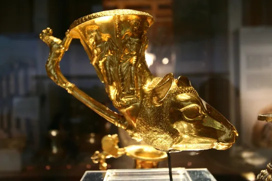
Thracian chiefs were rich in gold, silver and horses, and Greek cities on their coasts traded with them; Thracian soldiers fought as mercenaries for Greek cities. Like the Celts, they left almost no writing. We know them through Greek writers and through archaeology, above all their painted tombs and their treasures of gold and silver vessels.
The Scythians of the steppe
On the steppe north of the Black Sea, between the Danube and the Don, lived the Scythians, nomads who spoke an Iranian language, related to Persian. They had come from further east, from Asia, in the 8th and 7th centuries BC; Herodotus says that the nomadic Scythians “inhabiting Asia” were driven west by another people and took over the land of the Cimmerians.36Herodotus, Histories 4.11.1Written c. 430–425 BC, from what Herodotus saw and was told. Translation by A. D. Godley (1920)Read on Perseus ↗ They lived in wagons and tents, with great herds of horses, cattle and sheep, and fought as mounted archers. Herodotus admired one thing about them above all: “when men have no established cities or forts, but are all nomads and mounted archers”, “how can they not be invincible and unapproachable?”37Herodotus, Histories 4.46.3Written c. 430–425 BC, from what Herodotus saw and was told. Translation by A. D. Godley (1920)Read on Perseus ↗
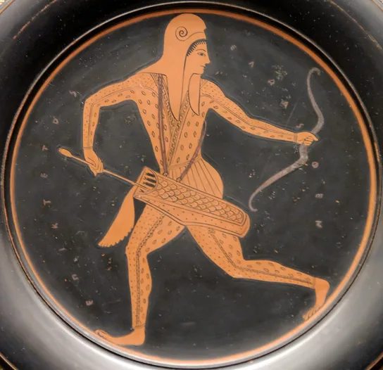
Not all Scythians were nomads. Herodotus describes, north of the Greek port of Olbia, “Scythian farmers, who plant grain not to eat but to sell”, to the Greek traders on the coast; this grain fed Greek cities.38Herodotus, Histories 4.17.2Written c. 430–425 BC, from what Herodotus saw and was told. Translation by A. D. Godley (1920)Read on Perseus ↗ Their rulers were buried under huge mounds, called kurgans, with horses, servants and masterpieces of gold, many of them made by Greek craftsmen for Scythian customers.
The Scythians told their own story of where they came from, and Herodotus recorded it, though he did not believe it. They said they were “the youngest in the world”, descended from Targitaus, a son of Zeus and of a daughter of the river Dnieper, whose youngest son became king when golden gifts fell from the sky: a plough, a yoke, a sword and a cup.39Herodotus, Histories 4.5.1Written c. 430–425 BC, from what Herodotus saw and was told. Translation by A. D. Godley (1920)Read on Perseus ↗ The Greeks of the Black Sea had another version, in which the Scythian kings descended from Heracles. It is one of the few places where we can hear something of a people’s own idea of themselves, even if only through a Greek writer.
Persia crosses into Europe
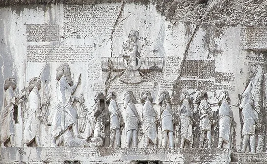
In the east lay the largest empire the world had yet seen. In less than thirty years after 550 BC, the Persians under Cyrus the Great and his successors had conquered the Medes, Lydia in Asia Minor with the Greek cities of its coast, Babylon and Egypt. Their king Darius I, who took power in 522 BC, ruled from the Aegean to the river Indus. On the rock of Behistun in western Iran he had his victories carved in three languages, with a list of twenty-three lands that obeyed him, beginning “By the grace of Auramazda am I king”.40Behistun inscription of Darius I, col. I §5Carved c. 520 BC on Darius’ orders: his own words. Translation by L. W. King and R. C. Thompson (1907)Read on archive.org ↗ Ionia, the Greek cities of Asia Minor, was on the list. No land in Europe was, yet.
Around 513 BC Darius led an army against the Scythians. His engineer Mandrocles, a Greek from Samos, built a bridge of boats across the Bosporus, and Darius, Herodotus says, “crossed over to Europe”, while a fleet of Ionian Greeks sailed into the Black Sea to bridge the Danube.41Herodotus, Histories 4.89.1Written c. 430–425 BC, from what Herodotus saw and was told. Translation by A. D. Godley (1920)Read on Perseus ↗ It was the first time an army from Asia had marched into Europe on this scale. The campaign against the Scythians failed. They “determined not to meet their enemy in the open field”, but retreated across the steppe, driving their herds away and filling in the wells, and Darius had to turn back.42Herodotus, Histories 4.120.1Written c. 430–425 BC, from what Herodotus saw and was told. Translation by A. D. Godley (1920)Read on Perseus ↗
The Persians did not leave Europe. Darius left his general Megabazus behind, who marched through Thrace, “subduing to the king’s will every city and every people of that region”.44Herodotus, Histories 5.2.2Written c. 430–425 BC, from what Herodotus saw and was told. Translation by A. D. Godley (1920)Read on Perseus ↗ In practice Persian power ran along the coast of Thrace, the road between the straits and Macedonia; the Thracian tribes inland stayed largely free. Megabazus also sent envoys to Amyntas, king of Macedon, to demand “earth and water”, the sign of submission, and Amyntas “readily gave to them what they asked”.45Herodotus, Histories 5.18.1Written c. 430–425 BC, from what Herodotus saw and was told. Translation by A. D. Godley (1920)Read on Perseus ↗ By about 510 BC the Persian Empire reached the borders of mainland Greece.
About twenty years later, Persia turned on Greece. When the Greek cities of Asia Minor rebelled in 499 BC, Athens sent twenty ships to help them, ships that Herodotus calls “the beginning of troubles for both Greeks and foreigners”.46Herodotus, Histories 5.97.3Written c. 430–425 BC, from what Herodotus saw and was told. Translation by A. D. Godley (1920)Read on Perseus ↗ The story of the Ionian Revolt, of the Persian expedition of 492 BC, when Mardonius “added the Macedonians to the slaves that they had already”,47Herodotus, Histories 6.44.1Written c. 430–425 BC, from what Herodotus saw and was told. Translation by A. D. Godley (1920)Read on Perseus ↗ and of the battles of Marathon, Thermopylae and Salamis is told in detail in our story of the Persian Wars.
Europe seen from the king’s court
To a Persian at the court of Darius, “Europe” was not a continent but the far north-western edge of the world, beyond the sea. The king’s own inscriptions do not speak of Europe and Asia at all. They speak of lands and peoples, each listed under its own name, who brought tribute to the king “by the grace of Auramazda”. After the campaigns of 513 BC the lists in later royal inscriptions add new peoples: Skudra, probably Thrace, the Saka “beyond the sea”, probably the Scythians of Europe, and the Yauna, the Ionians or Greeks, including those “who wear the petasos”, the broad Macedonian or Thracian hat. For the Persians these were peoples on the edge of an empire that already ruled most of the known world.48A. Kuhrt, The Persian Empire: A Corpus of Sources from the Achaemenid Period (London, 2007)Modern collection of the Persian kings’ own inscriptions in translation, with the lists of peoples of the empireFind in a library (WorldCat) ↗
Herodotus, who grew up as a Persian subject in Halicarnassus, says the Persians saw a clear line between the two continents: they “claim Asia for their own”, while “Europe and the Greek people they consider to be separate from them”.49Herodotus, Histories 1.4.4Written c. 430–425 BC, from what Herodotus saw and was told. Translation by A. D. Godley (1920)Read on Perseus ↗ He also put the dream of conquering Europe into Persian mouths. In his version of the council of 481 BC, Mardonius told King Xerxes that Europe was “an extremely beautiful land, one that bore all kinds of orchard trees”, “worthy of no mortal master but the king”,50Herodotus, Histories 7.5.3Written c. 430–425 BC, from what Herodotus saw and was told. Translation by A. D. Godley (1920)Read on Perseus ↗ and Xerxes said he would make all the earth one country “when I have passed over the whole of Europe”.51Herodotus, Histories 7.8C.2Written c. 430–425 BC, from what Herodotus saw and was told. Translation by A. D. Godley (1920)Read on Perseus ↗ These are speeches written by a Greek decades later, not Persian records. They tell us how Greeks imagined Persian ambitions after they had defeated them.
The Persians’ own sources are few: royal inscriptions in stone, seals, and thousands of clay tablets from the treasury and fortification archives at Persepolis, which record rations, travel and workers, but no histories. No Persian account of the war against the Scythians or of the battles against the Greeks survives. The Persian kings do not seem to have thought these defeats worth recording. For them, the campaigns in Europe were a small part of a much bigger empire’s history; for the Greeks, they became the founding story of their freedom, and, eventually, of the idea that Europe and Asia were opposites.
How close is our evidence?
For the peoples of Europe around 500 BC our evidence is very uneven. For the Greeks and the Persians it is good: we have objects, buildings and inscriptions from the time, and Herodotus, who wrote within living memory of Darius’ campaigns, talked to people whose fathers had seen them. For Carthage and the Etruscans we have their cities, tombs and a handful of inscriptions, but their books are lost, and their history was written by Greeks and Romans, often their enemies, centuries later. For the Celts, Iberians, Illyrians, Thracians and Scythians we depend on short remarks by Greek writers, most of whom never visited them, and on archaeology. That is why the borders on our map are drawn with soft edges, and why modern archaeology and genetics can still change what we know, as they have done for the first farmers and for the Etruscans.
What comes next
So this is the stage on which the story of Europe begins. In politics and war: many small powers, Greek city-states, Etruscan cities and Celtic chiefdoms, with one great empire, Persia, pressing in from the east. In the economy: trade by sea along the Mediterranean and by river into the interior, with metals, wine, grain and slaves changing hands. In society and culture: many peoples and languages, only a few of them able to write. In religion: many gods everywhere, Greek, Etruscan, Celtic, Thracian and Scythian, while the Persian kings placed Auramazda, the wise lord, above all others.
The next chapter, Classical Greece, moves to a Greek city that had just tried something new: rule by the people. It follows Athens and Sparta through the Persian Wars, the golden age of Athens and the Peloponnesian War, and the thinkers whose questions Europe has asked ever since.
- Webster, Early European History (1917), §20
- United Nations, World Population Prospects 2024
- Herodotus, Histories 4.45.2
- Herodotus, Histories 4.45.4
- Herodotus, Histories 4.45.5
- Herodotus, Histories 1.2.1
- R. Beekes, Etymological Dictionary of Greek (Leiden, 2010), entry “Εὐρώπη”
- Herodotus, Histories 4.36.2
- Herodotus, Histories 4.42.1
- Herodotus, Histories 5.49.1
- Herodotus, Histories 3.115.2
- Herodotus, Histories 1.163.1
- Webster, Early European History (1917), §20
- Herodotus, Histories 4.48.1
- Herodotus, Histories 4.49.3
- OpenStax, World History vol. 1 (2022), 2.3
- Z. Hofmanová et al., “Early farmers from across Europe directly descended from Neolithic Aegeans”, PNAS 113 (2016), pp. 6886–6891
- Herodotus, Histories 5.58.1
- OpenStax, World History vol. 1 (2022), 6.1
- Brooks, Western Civilization: A Concise History vol. 1, ch. 4
- Thucydides, History of the Peloponnesian War 1.13
- OpenStax, World History vol. 1 (2022), 6.1
- Thucydides, History of the Peloponnesian War 6.2
- Polybius, Histories 3.22
- Polybius, Histories 3.23
- OpenStax, World History vol. 1 (2022), 6.1
- Herodotus, Histories 1.94.6
- C. Posth et al., “The origin and legacy of the Etruscans through a 2000-year archeogenomic time transect”, Science Advances 7 (2021), eabi7673
- T. J. Cornell, The Beginnings of Rome: Italy and Rome from the Bronze Age to the Punic Wars (London, 1995)
- Herodotus, Histories 2.33.3
- B. Cunliffe, The Ancient Celts (Oxford, 2nd ed. 2018)
- Caesar, Gallic War 6.14
- Herodotus, Histories 1.163.2
- Herodotus, Histories 5.3.1
- Herodotus, Histories 5.3.2
- Herodotus, Histories 4.11.1
- Herodotus, Histories 4.46.3
- Herodotus, Histories 4.17.2
- Herodotus, Histories 4.5.1
- Behistun inscription of Darius I, col. I §5
- Herodotus, Histories 4.89.1
- Herodotus, Histories 4.120.1
- Herodotus, Histories 4.87.1
- Herodotus, Histories 5.2.2
- Herodotus, Histories 5.18.1
- Herodotus, Histories 5.97.3
- Herodotus, Histories 6.44.1
- A. Kuhrt, The Persian Empire: A Corpus of Sources from the Achaemenid Period (London, 2007)
- Herodotus, Histories 1.4.4
- Herodotus, Histories 7.5.3
- Herodotus, Histories 7.8C.2